title: Spatial Analysis for Decisions summary: Answers to 'where?' questions: the best sites, the riskiest zones, the parcels that matter.
Service
Spatial Analysis for Decisions
Answers to 'where?' questions: the best sites, the riskiest zones, the parcels that matter.
What I deliver
- Site suitability analysis (multi-criteria) for solar energy and other projects
- Flood and natural hazard mapping, watershed and hydrological analysis
- Cadastral and parcel analysis
- Network analysis: routes, service areas and travel time
- Exposure and vulnerability studies
Tools
ArcGIS Pro (Spatial Analyst, Network Analyst), QGIS, Python, GEE
Related projects
 Featured
Spatial Analysis
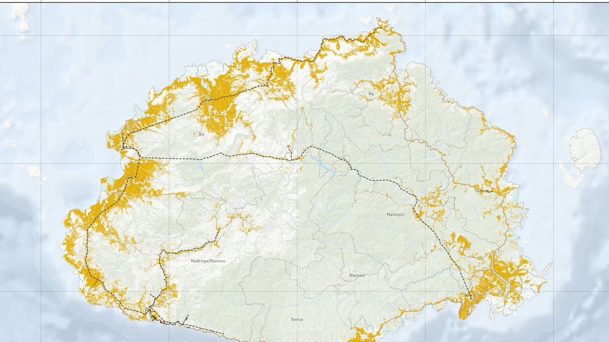
Where to build solar on Viti Levu, Fiji: a suitability model
A weighted raster model ranking 10,688 km² of Fiji's main island and finding 1,379 km² suitable for photovoltaic infrastructure.
 Featured
Spatial Analysis
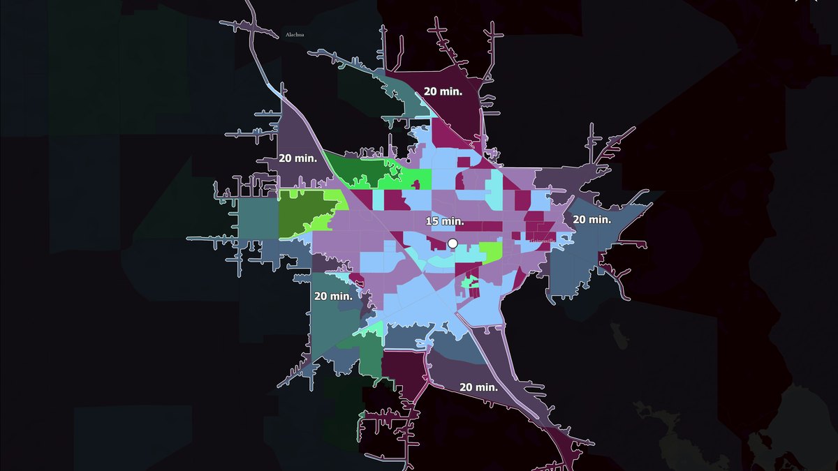
Drive-time service areas around a business location
A 5- to 30-minute service-area map that shows which neighbourhoods a site can reach and how much population lives inside each ring.
Next step
Need something similar?
Tell me about your data and your goal. I will reply with a clear approach, timeline and quote.