Remote Sensing & GEE
Carbon and vegetation analysis for priority ecosystems in Cojedes
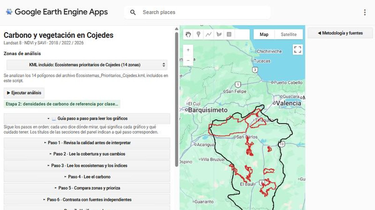
A Google Earth Engine app that reads vegetation indices and carbon densities across 14 priority ecosystem zones, with a step-by-step guide.
The challenge
Scientific results are hard to review when they live in a script. The aim was to make an environmental analysis understandable and checkable for people who do not code.
The solution
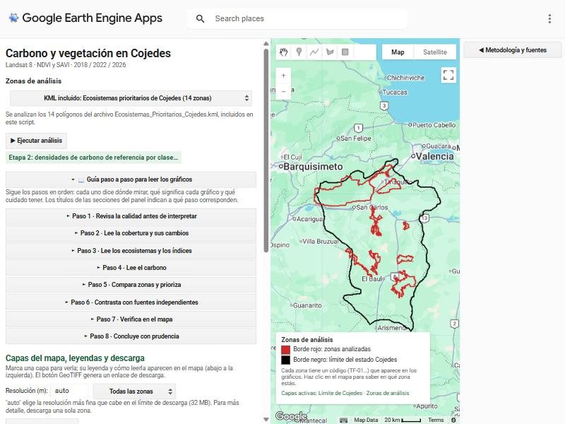
An Earth Engine app analyses 14 priority ecosystem polygons using Landsat 8 NDVI and SAVI for 2018, 2022 and 2026, links them to reference carbon densities by cover class, and walks the reader through the charts in eight guided steps, from data quality to cautious conclusions.
- Zones: priority ecosystems loaded from a KML, with a code per zone shown on the map.
- Indices: vegetation indices and cover changes over time.
- Carbon: reference densities by class, compared with independent sources.
- Guide: a numbered reading guide, map legends and GeoTIFF export.
Results
- 14 zones analysed across three dates in one reproducible app
- A built-in method note, so the audience can judge the limits of the estimates
- Downloadable layers for further work
Deliverables
Earth Engine App · Methodology panel · GeoTIFF export
Gallery
Next step
Need something similar?
Tell me about your data and your goal. I will reply with a clear approach, timeline and quote.