Cartography
Site layout plans for landfill gas risk assessments
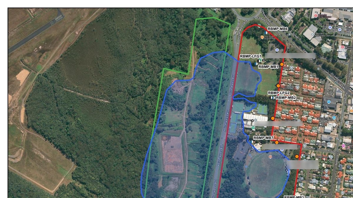
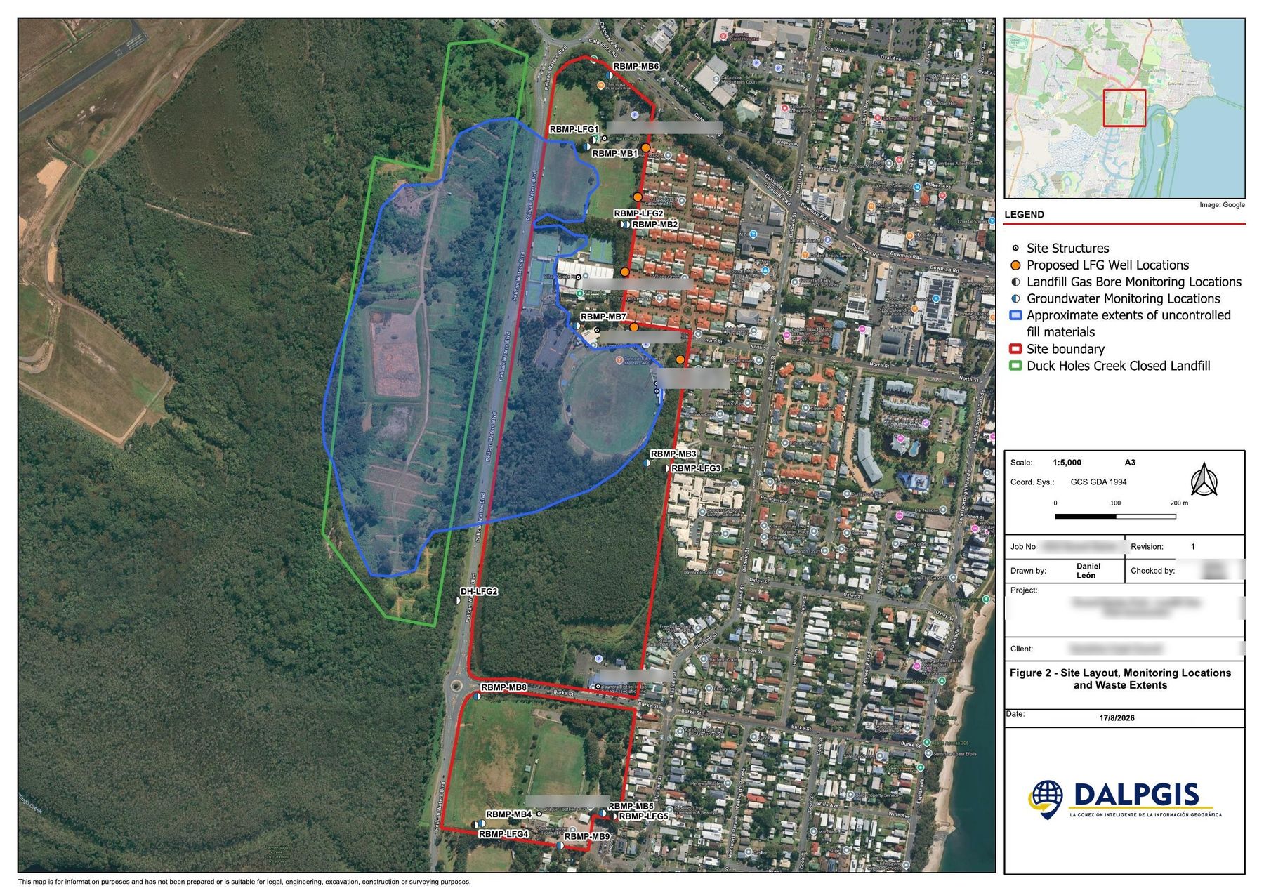
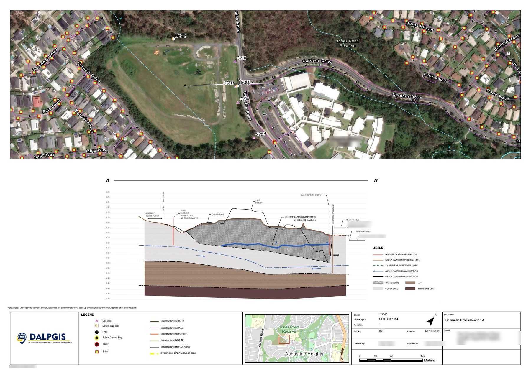
Print-ready A3 site plans and cross-sections showing monitoring wells, waste extents and site boundaries over aerial imagery.
The challenge
Environmental reports need clear, standardised figures: where the monitoring points are, where the waste is, where the site boundary runs. They must read well in print and follow the consultancy's title-block format.
The solution
I produce the maps as a white-label service: data prepared in GIS, symbology designed for readability at A3 and a title block that matches the report series.
- Prepare: digitise site boundary, waste extents and monitoring locations from client files and imagery.
- Design: legend, scale, coordinate system and north arrow; labels that stay legible over busy imagery.
- Deliver: PDF and image sheets, revised quickly when the consultant updates the data.
Results
- Consistent, report-ready figures, revised in hours when the data changes
- Same template reused across sites, so a new sheet is fast
- Plan and cross-section sheets in the same style
Deliverables
A3 site layout plans · Cross-section sheets · Editable GIS project
Gallery
Next step
Need something similar?
Tell me about your data and your goal. I will reply with a clear approach, timeline and quote.